South of Sankt Vith, archaeologists uncovered several Celtic burial mounds between 2005 and 2009. They are the first traces of permanent settlement in what is now eastern Belgium. We do not know how these people were linked to each other, by which paths or routes they travelled, nor where their religious, political, and economic centres were located.
The Romans created the first large centres after the conquest of Gaul (58-51 BC): they founded towns on the navigable rivers of the region: on the Rhine (such as Cologne and Bonn), and on the Moselle (such as Trier on a ford). They overcame forests and mountains by building roads. They founded urban centres at important road junctions (such as Tongeren or Arlon) or at hot springs (e.g., Aachen).
In the low mountain ranges of the Eifel and Ardennes, there was no navigable river. Here, an important Roman road led through this region, which was densely wooded with birch, oak, and beech trees: the Cologne-Reims road, which probably passed through present-day Thommen, Sankt Vith, Amel, and Büllingen. In present-day eastern Belgium, only a few Roman villas are known to have existed along this road. They were probably agricultural production sites. North of Eupen, archaeologists discovered a settlement at Baelen-Nereth that was inhabited from the 1st to the 4th century AD and where iron ore was mined. Archaeologists have likewise confirmed iron ore processing in the settlements at Lontzen-Krompelber and Baelen-Corbush during the 2nd century AD. However, in regional and supra-regional transport of the extracted material required, by necessity, the previous construction of roads.
Many backgrounds of these important lifelines are still unexplored today. Many questions remain unanswered: Who used these roads? Why did people use the roads? Where were resting stops located? Were there only isolated villas, or smaller towns as well? What secondary roads existed? It is certain that these roads remained important for centuries after the end of the Roman Empire. An example: a Roman (secondary) road led through the High Fens, a high moor. This road was probably built in the 1st century AD and has been proven to have still been maintained in the Carolingian period, i.e. in the early Middle Ages.
Numerous settlements then developed along these roads in the Middle Ages. The Merovingians, and later the Carolingians, also operated numerous royal courts along or near this old Roman road, such as in Thommen, Neundorf, Amel, Büllingen, Manderfeld, or Waimes. In the north, the royal courts of Baelen and Walhorn were established. King’s courts were economic estates owned by the king. They occasionally served as a place of residence for the rulers. After Charlemagne declared Aachen his seat of government, what is now eastern Belgium moved closer to the centre of power at the time.
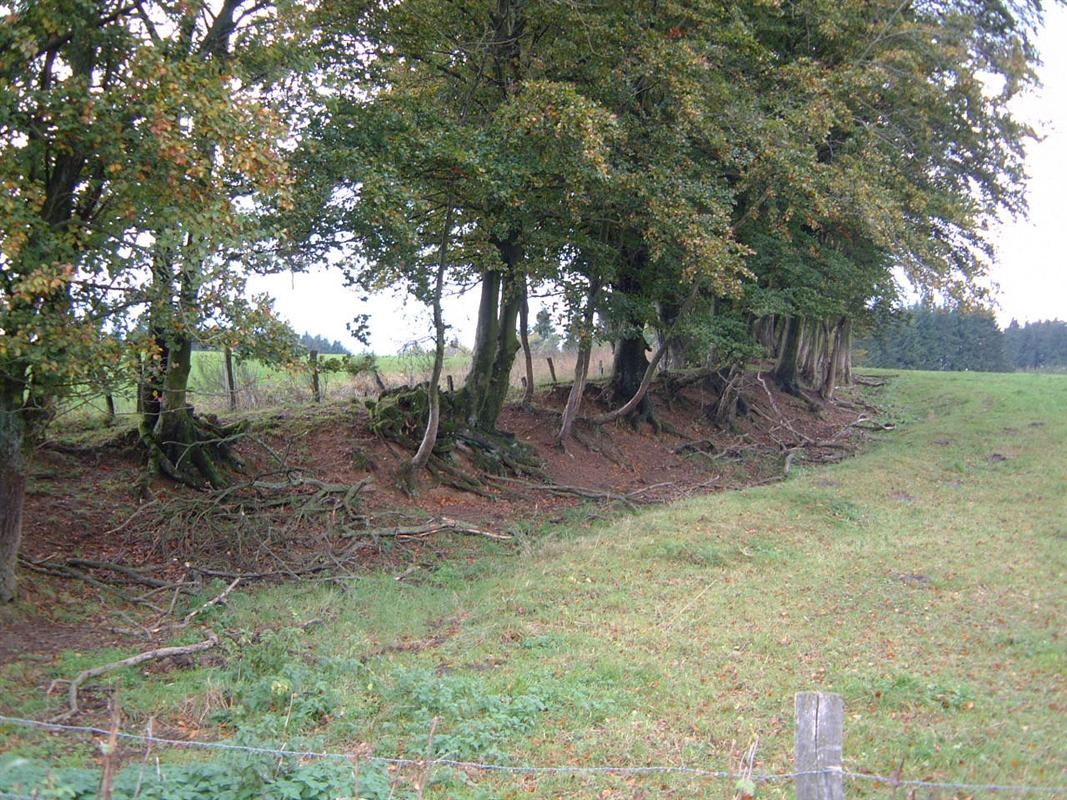
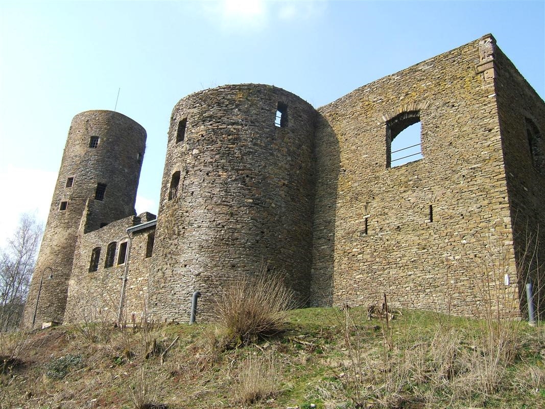
However, rivers and roads were not only networks for trade and commerce, but also for wars. In the 9th century AD, the Vikings advanced in boats across the rivers into the area between the Meuse and the Rhine and plundered the monasteries of Stavelot-Malmedy, Prüm and Kornelimünster, among others, but also the cities of Liège and Aachen. The nobles now had the first castles built, which were intended to offer protection and represent power. The castle of Reuland, for example, dates back to this time.
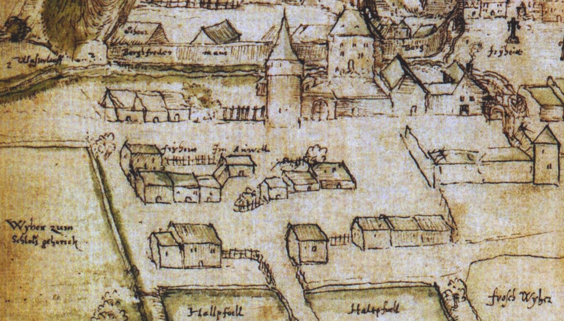
From the 10th century onwards, numerous towns with city walls (as a sign of protection), with a market (as an indication of economic power), and with a town hall (as a hallmark of self-government) arose all over Europe. In the Middle Ages, Sankt Vith was granted town status. The town was situated at the crossroads of the roads from Cologne to Sedan, and from Liège to Luxembourg in the middle of a large forest area. The town’s inhabitants probably lived to a large extent from intermediate trade between the towns on the Rhine, Meuse, and Moselle. The development of Eupen (first mentioned in 1213) into a small town took place much later.
However, rivers and roads, castles and towns were just as important for the development of regional rule. In the High Middle Ages, noble families in the region made increasing efforts to centralise and unify their scattered possessions. For this, accessibility via roads was also indispensable. In what is now East Belgium, the Dukes of Limburg and Brabant, the Dukes of Luxembourg, the Elector of Trier, the Prince-Bishop of Liège, the Prince-Abbot of Stavelot-Malmedy and the Lord of Schleiden had feudal rights, or even lordship.
These networks played no role in historiography, which, until the end of the 20th century, focused very much on the modern nation-state borders between Belgium and Germany. The Roman Empire and the Middle Ages in the region were often used (and misused) as a surface in which to project current political issues. On the one hand, poets, writers, and historians legitimised modern nation-states via legends of origins in the distant past, while on the other hand, rulers justified their claims to power via such tales. Noteworthy written sources for the region exist from the 8th century onwards.
History shows: Since ancient times, the settlement and development of the region have been fundamentally influenced by the network of roads and rivers. Today, life is guided by other networks. Is it still conceivable today to live without the internet, to do without social networks, or not to be reachable by mobile phone? How would leisure time, work, and shopping change? And would that be all negative?